We share the unknown structures found that are visible on the LIDAR maps in Poland. The found structures include, among others ancient farming systems with a total area exceeding continous over hundred square kilometers in some cases, settlements and graves. To give an overview we present a briefly summary of about 500 ancient fields (click here).

an example of field system 
same place as sattelite image 
cropmarks
To see more cropmarks of undated and unknown coaxial fields system on Polish territory probably dated of bronze or medieval period click here.
As a first published place we have choosen Sokółka County (Polish: powiat sokólski) in Podlaskie Voivodeship, north-eastern Poland, on the border with Belarus.


Presented structures are very similar to those located in North-Western Europe, widely publicated:
Field Systems Introductions to Heritage Assets
Reissue date v1.2 October 2018 © Historic England
Die Landschaft unter der Landschaft
Fund des Monats Januar 2016
Seven centuries of ploughing in Ede: Dutch Celtic fields used continuously for centuries
Research by University of Groningen archaeologist Stijn Arnoldussen, 2014
Ancient Fields, An Inventory of the Historical Monuments in Dorset
Volume 2, Pages 622-634. Her Majesty’s Stationery Office, London, 1970
Archaeological and historical aspects of West-European societies
Acta Archaeologica Lovaniensia, Monographie 8, 1995
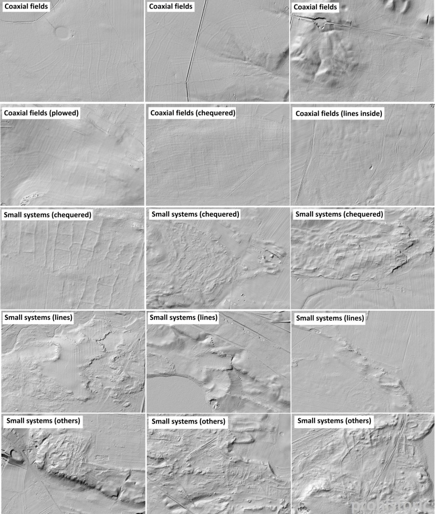
Below we present our first steps into the grouping of analized structures.